|
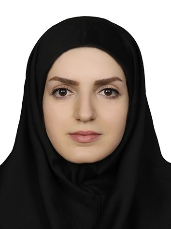
Dr. Parastoo Pilehforooshha
No. 1346, Valiasr St., Mirdamad cross, Tehran, Iran E-mail: pilehforoosh@kntu.ac.ir |
|
Main Research fields and interests
- Machine Learning and Data Mining
- Advanced Spatial Analysis in GIS
- Spatial Data Base Generalization
- Land Use Planning and Land Use Allocation
Current undergraduate (UG) and postgraduate (PG) courses
undergraduate (UG) courses: Advanced Programming (UG, KNTU)
Basics of Surveying (UG, KNTU)
Spatial Planning (UG, KNTU)
postgraduate (PG) courses: Spatial Data Mining (PG, KNTU)
Advanced Spatial Analysis in GIS (PG, KNTU)
Professional experience
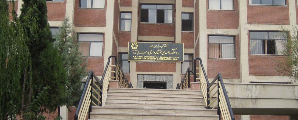
Jul. 2024 to present: Assistant professor, Deptartment. of GIS, Faculty of Geodesy and Geomatics Engineering, K. N. Toosi University of Technology, Tehran, Iran
Jan. 2025 to present: Director of postgraduate education, Faculty of Geodesy and Geomatics Engineering, K. N. Toosi University of Technology, Tehran, Iran
Academic Biography:
Sept. 2013-Sept. 2018 K.N. Toosi University of Technology, Faculty of Geodesy and Geomatics Engineering, Tehran, Iran
Ph.D. in Geospatial Information Systems (GIS)
Thesis title: Modeling of Topographic Database Generalization Using Extraction and Integration of Constraints
Sept. 2010- Feb. 2013 K.N. Toosi University of Technology, Faculty of Geodesy and Geomatics Engineering, Tehran, Iran
M. Sc. in Geospatial Information Systems (GIS)
Thesis title: Allocation of Agricultural Crops Using Multi-Objective Decision Making and Fuzzy Logic
Sept. 2006-Sept. 2010 K.N. Toosi University of Technology, Faculty of Geodesy and Geomatics Engineering, Tehran, Iran
B.Sc. in Surveying Engineering Department of Surveying Engineering, K.N. Toosi Technical University, Tehran, Iran
Publications:
Peer-reviewed journal article:
- Mousavi, M., Karimi, M., Pilehforooshha, P., Ahmadlou, M., Farhadi-Bansoleh, B. 2026. A new vector based model for crop land use allocation incorporating crop water requirements, Scientific Reports. https://doi.org/10.1038/s41598-026-44171-7
- Kazemi, S., Karimi, M. and Pilehforooshha, P., 2025. Comparative Analysis of Machine Learning and Deep Learning Algorithms for UAV-Based Rooftop Classification, Earth Observation and Geomatics Engineering. DOI: 10.22059/eoge.2026.409749.1197
- Balhas, K., Karimi, M. and Pilehforooshha, P., 2025. An Integrated Parcel-based Neighborhood Effect Model for Urban Land Use Allocation, Earth Observation and Geomatics Engineering. DOI: 10.22059/eoge.2026.402924.1190
- Ahmadi M, Karimi M, Pilehforooshha P., 2026. Modeling the Generalization and Simplification of River Networks Using Graph-based Neural Networks. Journal of Geomatics Science and Technology (JGST), 15 (4), 63-84
URL: http://jgst.issgeac.ir/article-1-1240-fa.html
- Zarei M., karimi M., Pilehforooshha P., 2026. Presenting a model for generalizing and simplifying road networks using graph-based deep learning methods. Journal of Geomatics Science and Technology (JGST), 15 (3), 71-90,
URL: http://jgst.issgeac.ir/article-1-1238-fa.html
- Balhas, K., Karimi, M. and Pilehforooshha, P., 2025. A new multi-level neighborhood parcel-based cellular automata model for urban land use allocation. Geo-spatial Information Science, pp.1-18. https://doi.org/10.1080/10095020.2025.2544959
- Khateri, Z., Karimi, M. and Pilehforooshha, P., 2025. Defining, Evaluating and Reducing Scenarios for Locating and Allocating Different Types of Educational Spaces using the Depth-First Search Algorithm, Journal of Geospatial Information Technology, Vol.13, No.2, pp 31-56. URL: http://jgit.kntu.ac.ir/article-1-977-fa.html
- Karimi, M., Pilehforooshha, P., Safari, A., 2024. Comparison of efficiency of random forest and support vector machine methods for Mineral Potential Mapping of copper deposits - Case study: Dahaj-Bazman. Scientific - Research Quarterly of Geographical Data (SEPEHR), 33(130), pp. 47-64. https://doi.org/10.22131/sepehr.2024.2012344.3023
- Lotfi, R., Pilehforooshha, P. and Karimi, M., 2023. A multi-objective optimization model for school location-allocation coupling demographic changes. Journal of spatial science, 68(2), pp.225-244. https://doi.org/10.1080/14498596.2021.1960649
- Pilehforooshha, P., Karimi, M. and Mansourian, A., 2021. A new model combining building block displacement and building block area reduction for resolving spatial conflicts. Transactions in GIS, 25(3), pp.1366-1395. https://doi.org/10.1111/tgis.12731
- Pilehforooshha, P. and Karimi, M., 2020. A local adaptive density-based algorithm for clustering polygonal buildings in urban block polygons. Geocarto International, 35(2), pp.141-167. https://doi.org/10.1080/10106049.2018.1508313
- Pilehforooshha, P. and Karimi, M., 2019. An integrated framework for linear pattern extraction in the building group generalization process. Geocarto International, 34(9), pp.1000-1021. https://doi.org/10.1080/10106049.2018.1458253
- Karimi, M., Mesgari, M.S., Sharifi, M.A. and Pilehforooshha, P., 2017. Developing a methodology for modelling land use change in space and time. Journal of Spatial Science, 62(2), pp.261-280. https://doi.org/10.1080/14498596.2017.1283253
- Pilehforooshha, P., Karimi, M. and Taleai, M., 2014. A GIS-based agricultural land-use allocation model coupling increase and decrease in land demand. Agricultural Systems, 130, pp.116-125. https://doi.org/10.1016/j.agsy.2014.07.001
- Ebrahimi, E., Karimi, M., Pilehforooshha, P., 2020. Land use allocation in rural areas using genetic algorithm, Journal of Geomatics Science and Technology (JGST), 10(3), pp. 69-86. http://jgst.issgeac.ir/article-1-936-fa.html
- Malek, M.R., Pilehforooshha, P., 2014. A Comparison between Traditional and Intuitionistic Fuzzy Logic for Vulnerability Mapping Under Uncertainty. Journal of Emergency Management, 5(6), pp. 5-13. 20.1001.1.23453915.1393.3.2.1.4
- Pilehforooshha, P., Karimi, M., Taleai, M., Farhadi Bansole, B., Sharifi, M.A., 2013. Modeling the required area of agricultural products using multi-objective programming and GIS. Journal of Applied research in Geographical Science, 13(30), pp. 191-210. http://jgs.khu.ac.ir/article-۱-۱۶۲۹-fa.html
- Pilehforooshha, P., Karimi, M., Taleai, M., 2014. Determining land suitability for the cultivation of agricultural products using GIS and fuzzy inference systems, Iranian Remote Sensing and GIS, 6(1). pp. 85-102.
- Pilehforooshha, P., Karimi, M., Taleai, M., 2013. Modeling land use allocation considering increase and decrease in land use demand. Iranian Remote Sensing and GIS, 5(1). pp. 51-69.
Peer-reviewed conference article:
- RezaAli, A., Pilehforooshha, P. 2026. Impact of the 2025 California Wildfires on Mountain Lion (Puma concolor) Habitat: A Remote Sensing and Species Distribution Modeling Framework, ISPRS Annals of the Photogrammetry, Remote Sensing and Spatial Information Sciences. DOI: 10.5194/isprs-annals-X-4-W8-2025-609-2026
- Hajisharafi, F., Pilehforooshha, P., 2025, Land use change modeling using the random forest method, 29th Conference on Surveying and Spatial Information (Goematics 1404), Tehran, Iran. https://civilica.com/doc/2652457/
- Farahani, M., Taleai, M., Pilehforooshha, P, 2025, Modeling and mapping the visual perception potential of the urban landscape using machine learning, 29th Conference on Surveying and Spatial Information (Goematics 1404), Tehran, Iran. https://civilica.com/doc/2652320/
- Pilehforooshha, P., karimi., M., May 2018, Spatial conflict reduction in building generalization process using optimization approaches, FIG Congress 2018, Istanbul, Turkey.
- Pilehforooshha, P., Alesheikh, A.A., Mousavi, F., May 2011. Evaluating earthquake vulnerability with the help of fuzzy logic and GIS (Case study: Tehran, District 16), 5th symposium on Advances in Science and Technology (5th SASTech), Mashhad, Iran. https://civilica.com/doc/157382
- Pilehforooshha, P., Alesheikh, A.A., Mousavi, F., April 2011. Assessment of earthquake vulnerability using fuzzy logic and optimal allocation of resources through data envelopment analysis (Case study: District 16 of Tehran municipality), Geomatics 94, Congress, Tehran, Iran.
- Mousavi, F., Alesheikh, A.A., Pilehforooshha, P. May 2011. Optimum site selection for support centers and health clinics by GIS and DEA (Case study:Tehran,District 16), 5th symposium on Advances in Science and Technology (5th SASTech), Mashhad, Iran.
Websites:
https://en.kntu.ac.ir/geomatics/
http://cv.kntu.ac.ir/parastoopilehforooshha