Honors and Awards
1. International Society for Photogrammetry and Remote Sensing (ISPRS) Travel Grant, 2012, The XXII Congress of the ISPRS, Melbourne, Australia
1. Best Paper Award, 2012, The second International Conference and Exhibition on Mapping and Spatial Information (ICMSI 2012) and 19th National Geomatics Conference, Tehran, Iran
2. Best Student Researcher Award, 2011, K. N. Toosi University of Technology, Tehran, Iran
3. International Cartographic Association (ICA) Travel Award, 2011, 25th International Cartographic Conference (ICC), Paris, France
4. Best Paper Award, 2007, Geomatics Conference, Azad University of Bonab, Iran
5. First Rank Student, 2000, Entrance Examination of Talented Student’s High School
Membership to Scientific Associations
1. Young Researchers Club, Azad University, Iran
2. Academic Student Researchers Club, Iran
3. GSSA: Geomatics Students Scientific Association, University of Tabriz, Iran
Publications
A: Books
1. Eghlima, F., Niroumand J., M., English for Geomatics Purpose, 2011, National Cartographic Center (NCC) Press, Tehran, IRAN.
B: Papers
1. Niroumand J., M., Sahebi, M.R. and Mokhtarzade, M., 2013, Enhancing the Locational Perception of Soft Classified Satellite Imagery through Evaluation and Development of the Pixel Swapping Technique. In: “Cartography: from pole to pole”, Springer (In Press).
2. Niroumand J., M., Safdarinezhad, A.R., Sahebi, M.R. and Mokhtarzade, M., 2012, A Novel Approach to Super Resolution Mapping of Multispectral Imagery Based on Pixel Swapping Technique. XXII ISPRS Congress, 25 August - 1 September, Melbourne, Australia.In: Peer-reviewed ISPRS Annals of Photogrammetry, Remote Sensing and Spatial Information Sciences, I-7, pp. 159-164.
3. Niroumand J., M., Sahebi, M.R. and Mokhtarzade, M., 2012, The Evaluation and Improvement of the Simulated Annealing Algorithm for Sub-pixel Land Cover Mapping From Multispectral Imagery, Iranian Journal of Remote Sensing and GIS (Accepted)
4. Niroumand J., M., Sahebi, M.R. and Mokhtarzade, M., 2012, The Evaluation and Development of the Pixel Swapping Technique for Sub-pixel Land Cover Mapping From Multispectral Imagery, Iranian Journal of Remote Sensing and GIS (Accepted)
5. Niroumand J., M., Jannati, M., Sahebi, M.R., and Mokhtarzade, M., 2012, Increasing the Accuracy of Land Cover Change Information Using the Outputs of Soft Classified Imagery (Case Study: Aharchay Basin), Modarres Social Science Journal: Environmental Management, (Accepted).
6. Jannati, M., Niroumand J., M., Valadan Zoej, M.J., and Mohammadzade, A., 2012, Extraction of Pure Pixels Using the Feature Space Based on Physical Parameters in order to Obtain Sub-pixel Land Cover Information, Modarres Social Science Journal: Environmental Management (Accepted).
7. Safdarinezhad, A., Sahebi, M.R., Niroumand J., M., 2011. A Novel Approach for Optimal Feature Selection and Sub-Pixel Mapping in Polarimetric Radar Images, Iranian Journal of Remote Sensing and GIS. Vol. 4, No. 1.
8. Niroumand J., M., Jannati, M., Safdarinezhad,. A.R., Sahebi, M.R., and Mokhtarzade, M., 2012, The Evaluation and Optimization of the Pixel Purity Index in order to Use in Linear Spectral Mixture Model, Geomatics 91 Exhibition and Conference, National Cartographic Center, Tehran, Iran
9. Jannati, M., Niroumand J., M., Valadan Zoej, M.J., Mohammadzadeh, A., and Safdarinezhad, A.R., 2012, Semi-Automatic Extraction of the Statistic Parameters of the Interest Classes based on the Image Clustering, Geomatics 91 Exhibition and Conference, National Cartographic Center, Tehran, Iran
10. Niroumand J., M., Helali, H., and Alesheikh., A. A., 2011. Optimal Visualization of Satellite Imagery and Superimposed Vector Data; a New Trend to the Conceptual Visualization of Land-Use Maps, 25th International Cartographic Conference, Paris, France
11. Niroumand J., M., Salehi, S. and Taleai, M., 2011. The Importance Evaluation of Remotely Sensed Data and Meta Data in SDI: Focus on Disaster Management, Geomatics 90 Exhibition and Conference, National Cartographic Center, Iran, Tehran.
12. Akbari, E., Niroumand J., M., Sahebi, M. R. and Ghaderizadeh, H., 2011. Accuracy Assessment of Maximum Likelihood and SVM Classifiers (Case Study: Change Detection Mapping of Taleghan basin, Iran), Geomatics 90 Exhibition and Conference, National Cartographic Center, Iran, Tehran.
13. Niroumand J., M., Helali, H. and Karami, H., 2010, Cartographic Visualization of Air Pollution Maps on the Web, The 4th Conference and Exhibition on Environmental Engineering, Tehran, Iran
14. Karami, H., Helali, H. and Niroumand J., M., 2010, Providing the Environmental GIS Data on the Google Earth, The 4th Conference and Exhibition on Environmental Engineering, Tehran, Iran
15. Niroumand J., M., 2009, The Evaluation of the Communication Function of TV Weather Maps, Fall Meeting, San Francisco, CA, USA, 14-18 Dec (Abstract submitted)
16. Helali, H., Niroumand J.,M., 2008, Visualization of Water Resources Features, Implementation for State database, 3rd Iran Water Resources Conference, Tabirz, Iran.
17. Niroumand J., M., 2008, Modern Cartography & New Map Types, Geomatics 87 Exhibition and Conference, National Cartography Center, Iran.
Research Interests
Cartography: GeoVisualization, Visual Variables, Modern Cartography, 3D Modeling
Remote Sensing: Soft Classification, Super Resolution Mapping
Languages:
English, Persian, Turkish
References
M.R. Sahebi, Assistant Professor, RS Department, Geomatics Engineering Faculty, K.N. Toosi University of Technology, Tel: (+98 21) 88770218, Fax: (+98 21) 88786213, email: Sahebi@kntu.ac.ir
M. Mokhtarzade, Assistant Professor, RS Department, Geomatics Engineering Faculty, K.N. Toosi University of Technology, Tel: (+98 21) 88770218, Fax: (+98 21) 88786213, email: m_mokhtarzade@kntu.ac.ir
Copyright © 2009-2012 by "Milad Niroumand" · All Rights reserved · E-Mail: niroumand@sina.kntu.ac.ir
Educational Background
Certificate Degree Field of Specialization Name of Institution Attended Date Received
Bachelor of Science Geomatics Engineering University of Tabriz, Tabriz, IRAN 2009
Pre- University Mathematics & Physics Aboureihan, Marand, IRAN 2005
Diploma Mathematics & Physics Aboureihan, Marand, IRAN 2004
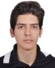
Milad Niroumand Jadidi
M.Sc. in Remote Sensing Eng.,
Department of RS Engineering,
Faculty of Geomatics Engineering ,
K.N. Toosi University of Technology
Date of Birth: 1987 Nationality: I.R. IRAN
Email: milad.niroumand@yahoo.com
M.Sc. in Remote Sensing Eng.,
Department of RS Engineering,
Faculty of Geomatics Engineering ,
K.N. Toosi University of Technology
Date of Birth: 1987 Nationality: I.R. IRAN
Email: milad.niroumand@yahoo.com


Milad Niroumand's Home Page

Curriculum Vitae
Master of Science Remote Sensing Eng. K.N.Toosi University of Technology, IRAN 2012